City routes, live traffic, transit routes, parking, offline map and navigation.
We're excited to announce that we've updated 2GIS to better showcase the wealth of information we've gathered about cities and businesses. The new version features a refreshed design, an enhanced search function, improved city updates, and a seamless integration of favorites with 2gis.ru.
Services, Addresses, and Companies
2GIS is your go-to resource for finding out which utility provider serves your home, locating your nearest district hospital or post office, and choosing the perfect cafe or service center based on reviews and photos. It provides comprehensive details including opening hours and contact numbers.
Transport and Navigation
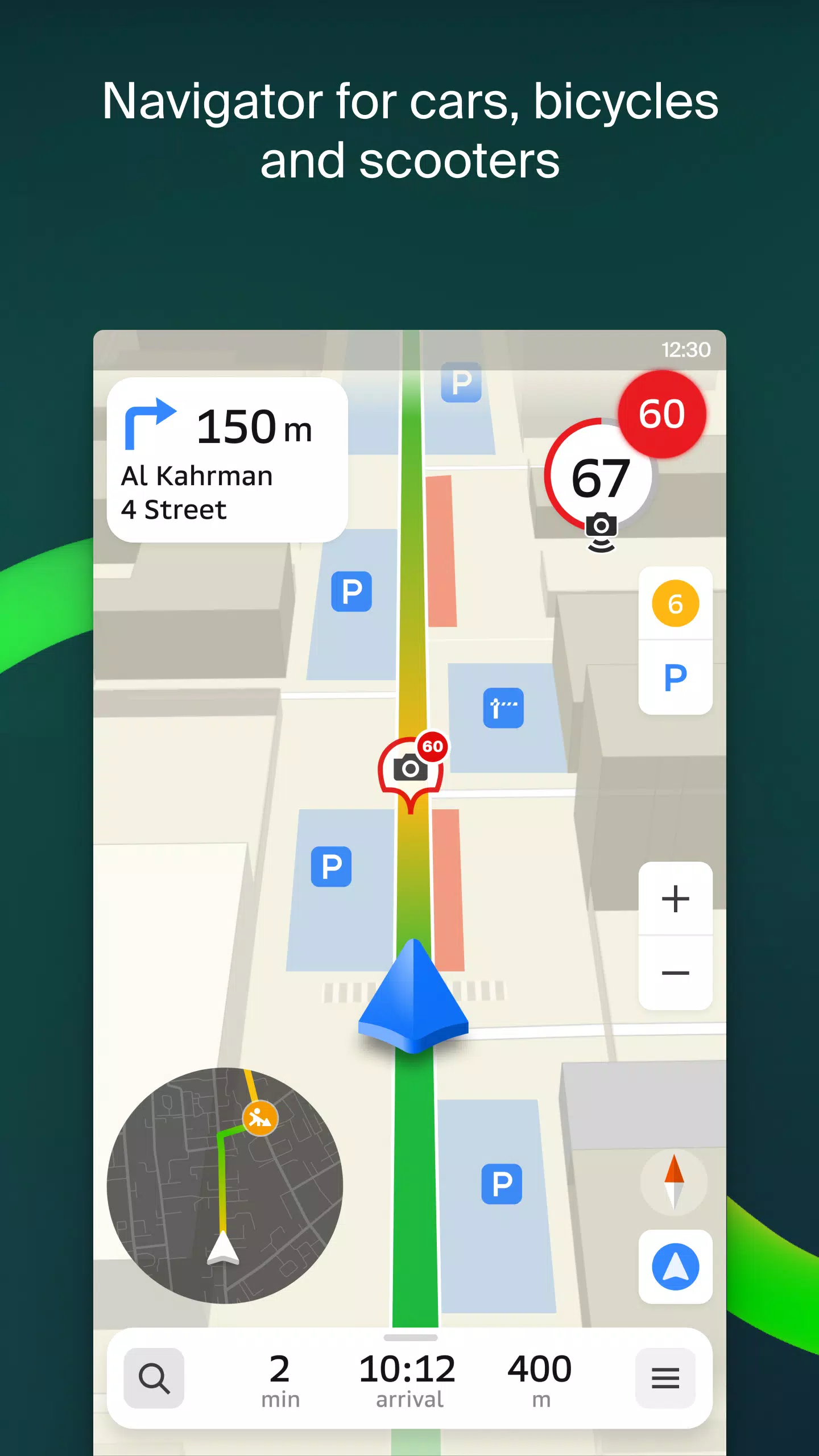
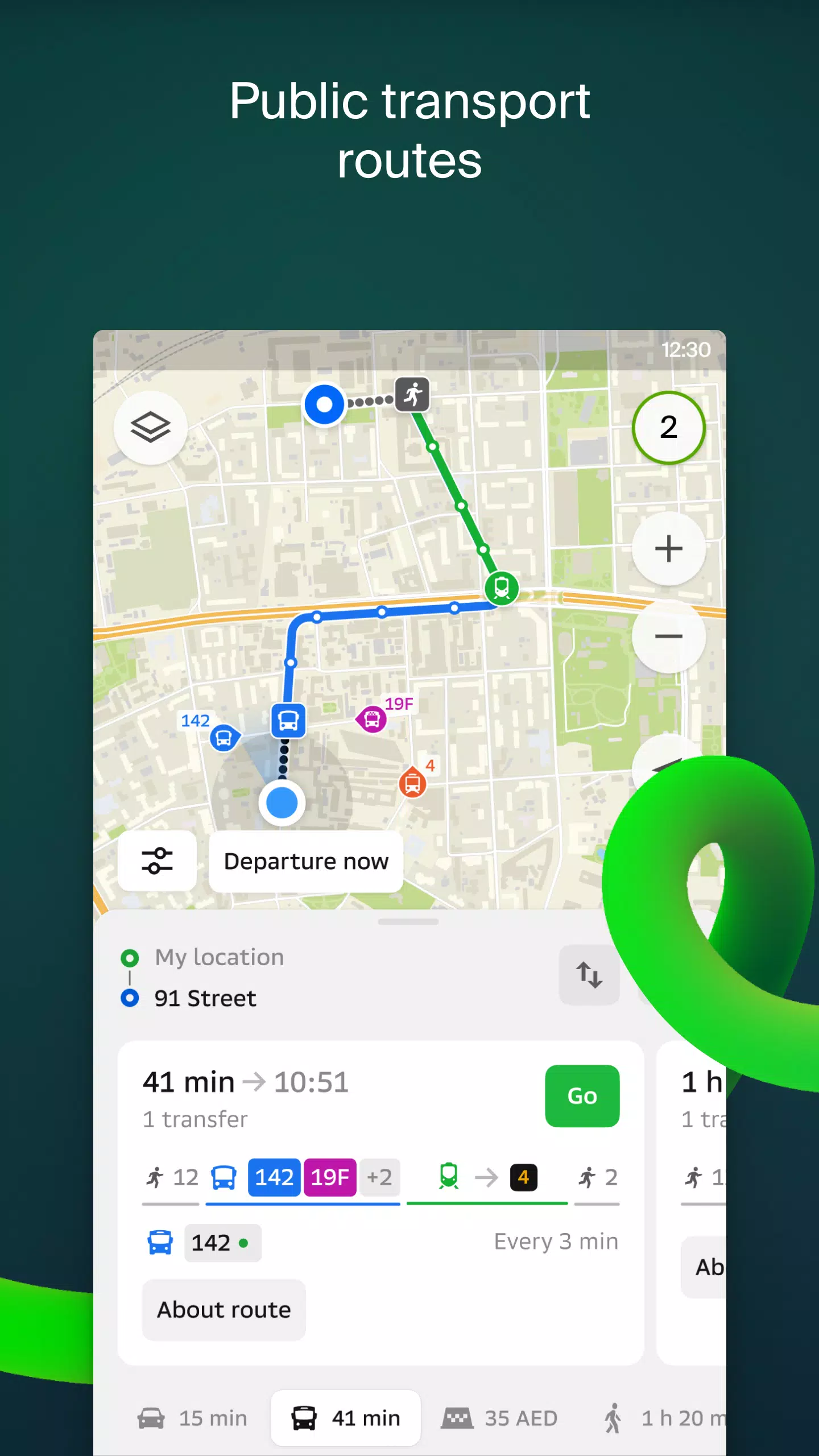
For drivers, 2GIS offers real-time guidance with voice instructions, taking into account traffic conditions and road closures. It dynamically updates your route if you stray from the planned path. For those on foot, it suggests optimal routes using buses, metro, trains, cable cars, and river trams.
Walking Routes
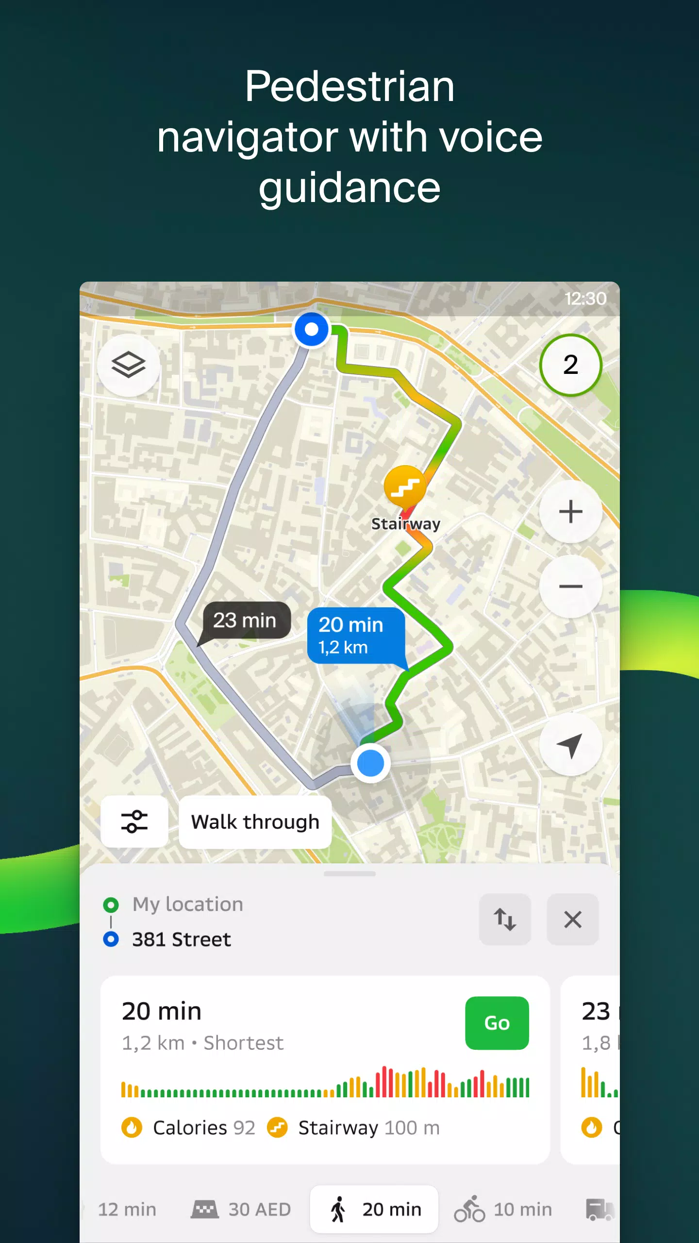
Our pedestrian navigation system charts a course for any walkable path, offering background operation and voice guidance to keep you on track.
Friends on the Map
With 2GIS, you can now track the real-time locations of friends and family. Add friends, control who sees your location, and manage your visibility settings with ease.
Building Entrances
Say goodbye to wandering around business centers. 2GIS knows the entrances to over 2.5 million companies, guiding you directly to the door for both public transport and car routes.
Plans of Shopping Centres
Navigate shopping centers effortlessly with 2GIS. From stores and cafes to ATMs and restrooms, plan your visit in advance to maximize your time.
2GIS Beta Notifications Companion App for Smart Watches
Our new beta companion app for Wear OS smart watches enhances your navigation experience. Whether on foot, bike, or public transport, view maps, receive maneuver hints, and get vibration alerts as you approach turns or bus stops. The app launches automatically when you start navigation on your phone and is compatible with Wear OS 3.0 and later.
By joining the beta, you'll receive the latest updates as we fix bugs and refine features, contributing directly to the development of a new version that will be used by millions. No need to uninstall the original app; you can switch between the beta and standard versions at any time.
Support: [email protected]
What's New in the Latest Version 6.44.1.559.3
Last updated on Oct 19, 2024
We're thrilled to roll out these beautiful, crisp updates for you:
- Enjoy wide, realistic road displays on the main map and during route searches.
- Introducing Chats for Friends! Now you can communicate directly within the app without leaving the map.
- Get notified when a friend is nearby (you can disable this feature in settings).
- Just in time for the ski season, we've added ski lift statuses so you can check if they're operational.
- For public transport routes that involve walking, we now calculate the walking portion in steps.
Tags : Maps & Navigation