Record your GPS tracks during your trips, analyze detailed statistics, and share your adventures with friends using Geo Tracker. If you're in search of a versatile GPS tracker that supports both Open Street Maps and Google Maps, and you enjoy outdoor activities or traveling, this app is tailored for you!
Geo Tracker can assist you in various ways:
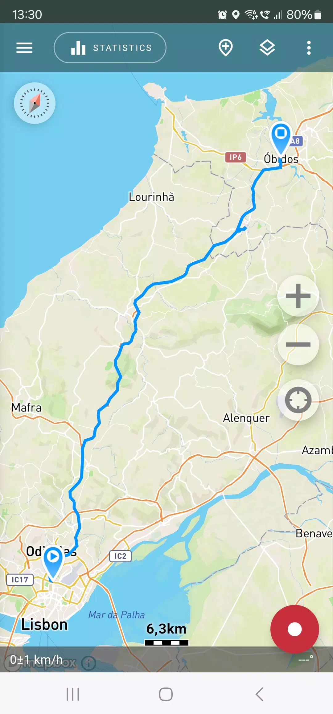
- Navigating back through unfamiliar areas without losing your way;
- Sharing your travel routes with friends;
- Utilizing routes from others via GPX, KML, or KMZ files;
- Marking significant or intriguing points along your journey;
- Locating specific points on the map using known coordinates;
- Showcasing colorful screenshots of your achievements on social media.
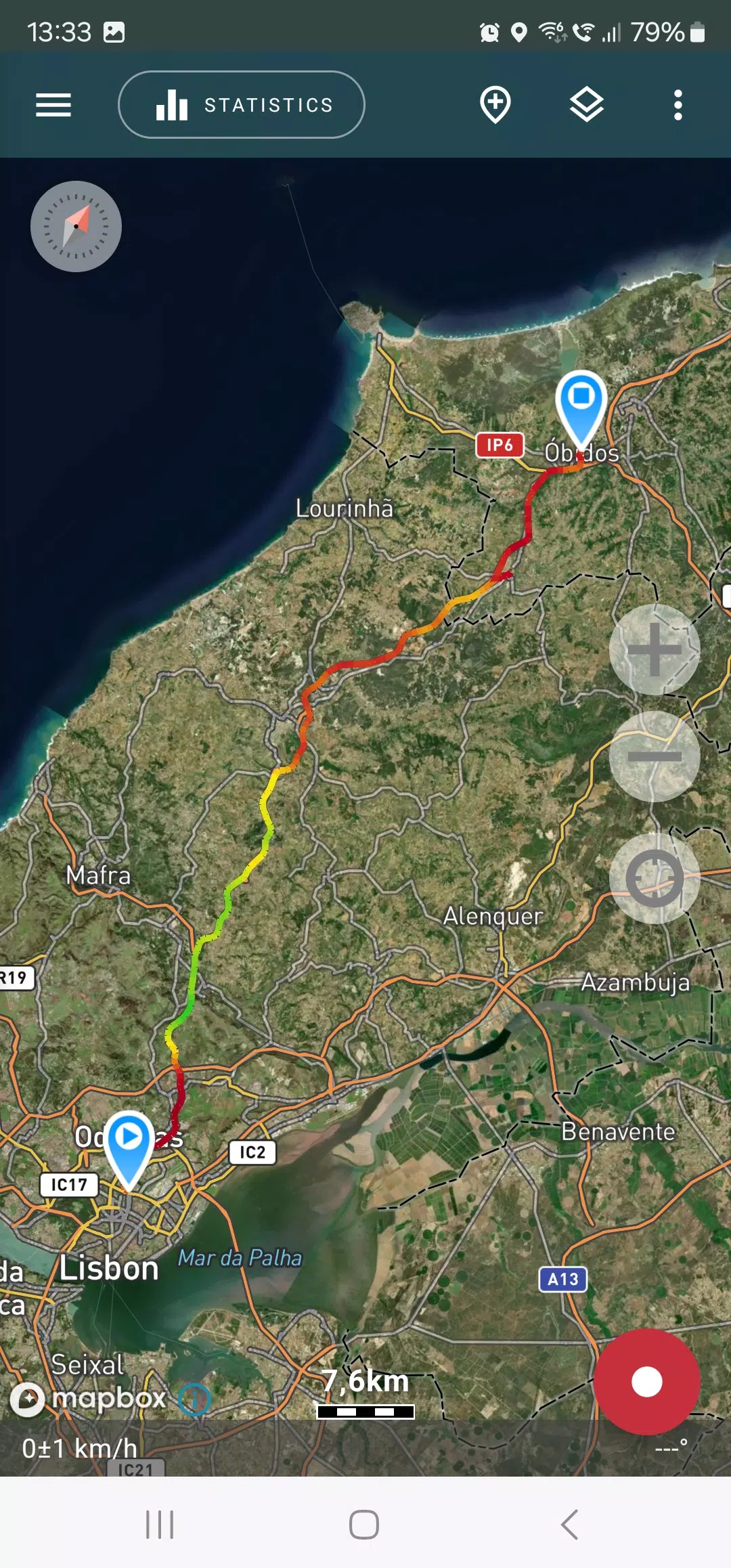
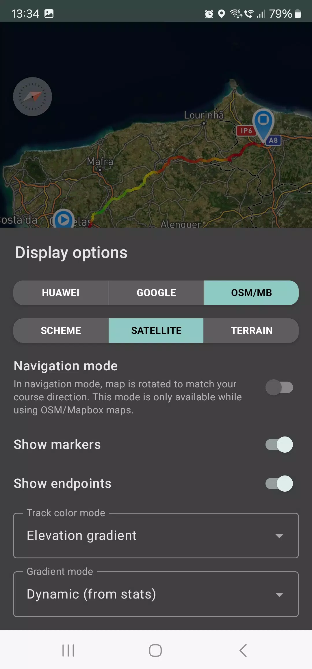
Within the app, you can view your tracks and the surrounding area using maps from OSM or Google, as well as satellite imagery from Google or Mapbox, ensuring you have the most detailed maps available anywhere in the world. The areas you explore are cached on your device, allowing for offline access, which works particularly well with OSM maps and Mapbox's satellite images. To record and calculate track statistics, you only need a GPS signal; internet connectivity is only required for downloading map images.
While driving, you can activate navigation mode, which rotates the map in the direction of your travel, simplifying your journey. The app can also record tracks in the background (on many devices, this requires additional system settings - follow the instructions provided in the app). Background mode is optimized for power consumption, allowing for up to a full day of recording on a single charge. You can also enable an economy mode in the app settings for further energy savings.
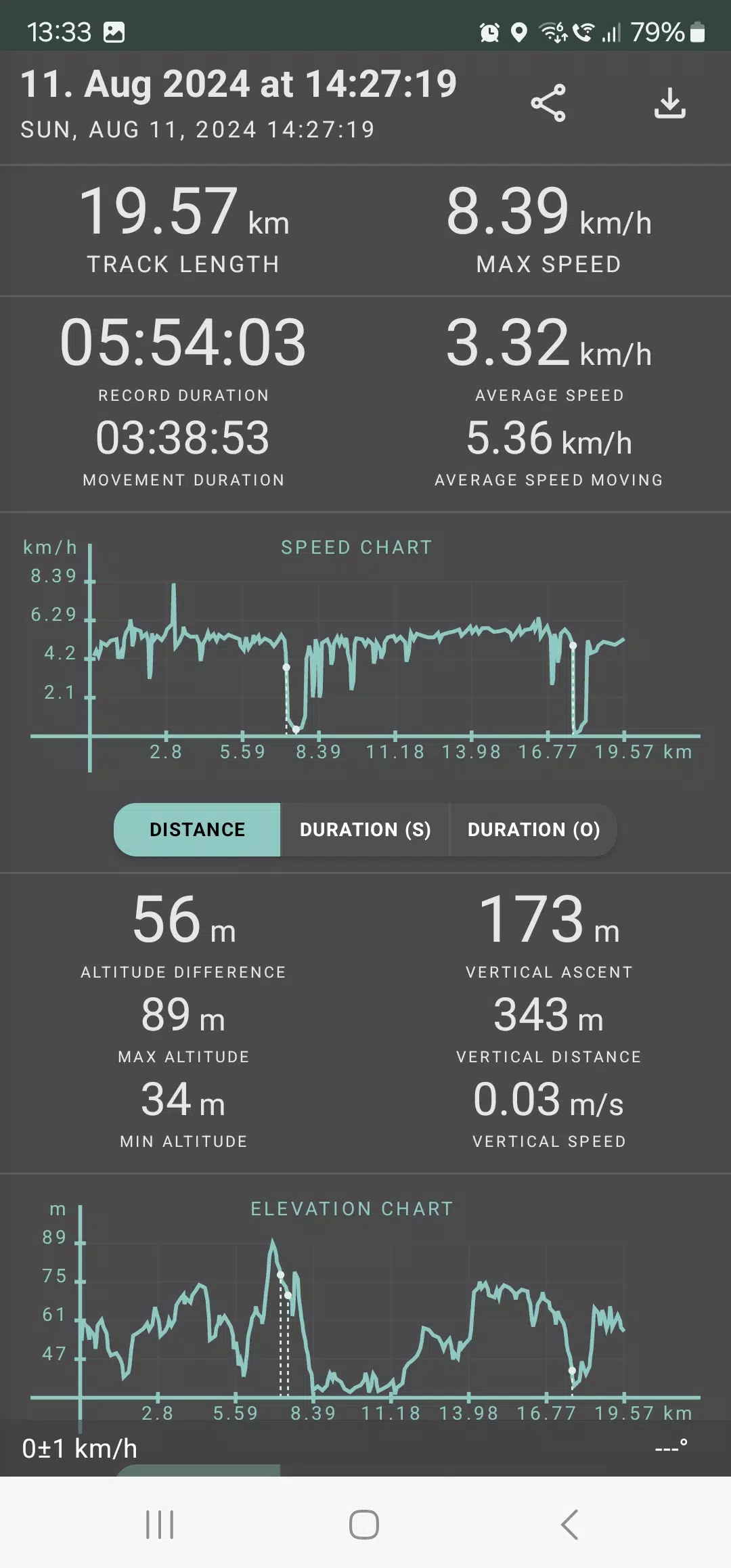
Geo Tracker calculates a comprehensive set of statistics, including:
- Distance traveled and total recording time;
- Maximum and average speed along the track;
- Time spent in motion and average speed during motion;
- Minimum and maximum altitude, as well as altitude difference;
- Vertical distance, ascent, and speed;
- Minimum, maximum, and average slope.
Additionally, detailed charts of speed and elevation data are available for in-depth analysis. Recorded tracks can be saved in GPX, KML, and KMZ formats, making them compatible with other popular applications like Google Earth or Ozi Explorer. All track data is stored locally on your device and is not transmitted to any servers.
The app does not rely on ads or your personal data for revenue. However, you can support ongoing development by making a voluntary donation within the application.
Here are some useful tips and tricks to address common GPS issues with your smartphone:
- When starting tracking, wait a moment for the GPS signal to be acquired.
- Restart your smartphone and ensure you have an unobstructed view of the sky before starting (avoid high buildings, forests, etc.).
- Be aware that GPS reception can vary due to factors like weather, season, satellite positioning, areas with poor GPS coverage, high buildings, and forests.
- In your phone settings, navigate to "Location" and enable it.
- In your phone settings, go to "Date & Time" and turn on "Automatic date & time" and "Automatic time zone" to ensure accurate time settings, which can affect GPS signal acquisition.
- Disable airplane mode in your phone settings.
If these tips do not resolve your issues, try uninstalling and then reinstalling the app. Remember, Google Maps uses not only GPS data but also additional location data from nearby WLAN networks and/or mobile networks.
For more answers to common questions and solutions to popular issues, visit our website at https://geo-tracker.org/faq/?lang=en.
Tags : Travel & Local