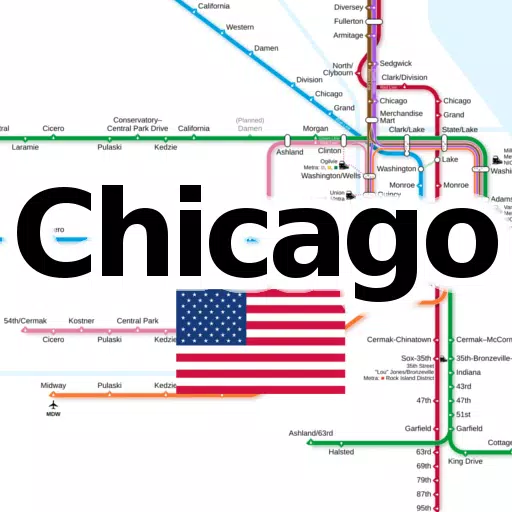
Discover all the essential subway and railroad maps of Chicago consolidated into one convenient application. This app is a must-have for both Chicago residents and tourists looking to navigate the city's public transit system with ease.
The following line networks are available offline, requiring no additional downloads:
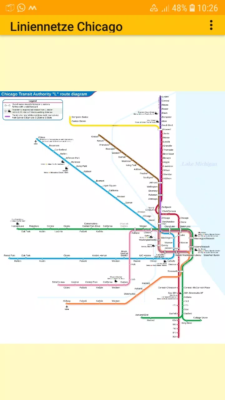
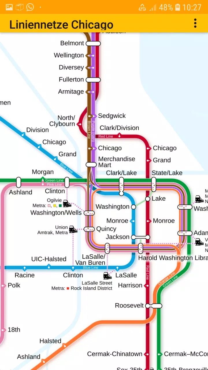
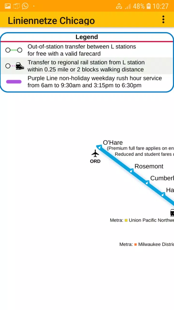
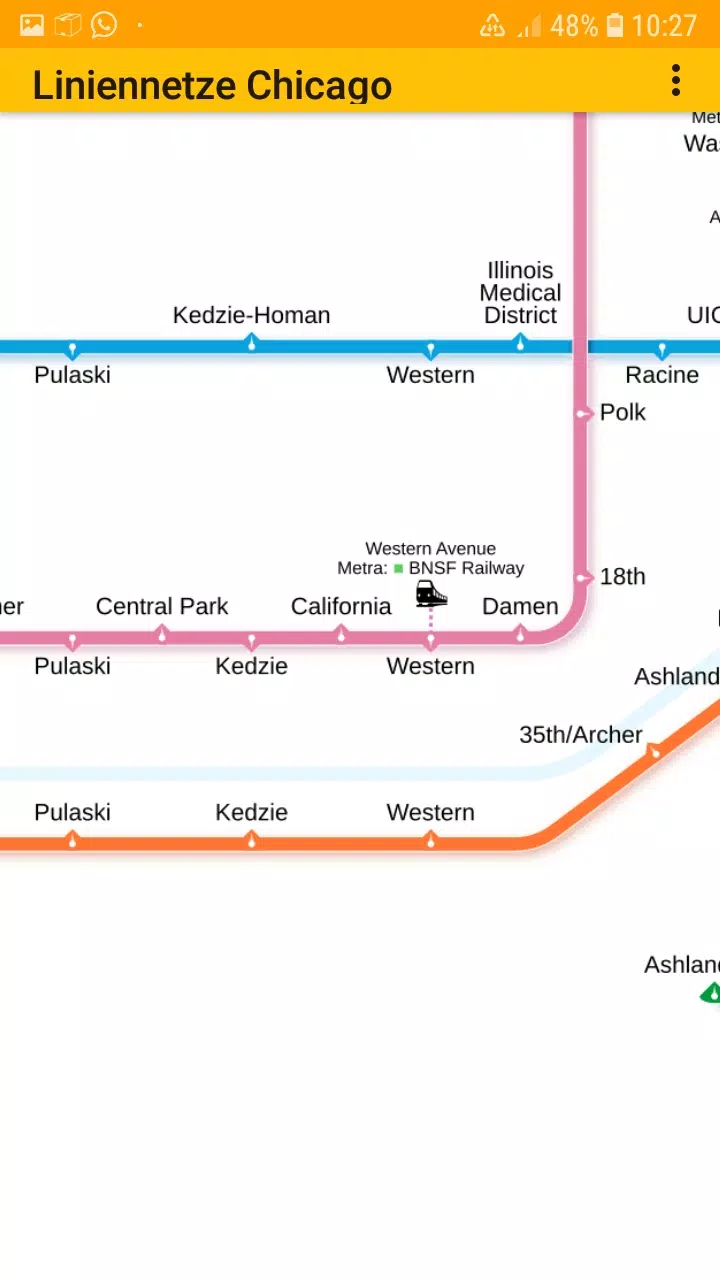
- Chicago elevated "L" rapid transit system
With this app, you can effortlessly zoom in and out of the maps, making it simple to explore and understand the transit networks. The application features multiple tabs, each dedicated to different types of transit maps, ensuring you find exactly what you need.
The metro line network, also known as the underground, rail transit map, urban tube map, or public subway, is just a few taps away. Whether you're planning your commute or a day of sightseeing, this app is your go-to guide for Chicago's transit system.
We value your feedback! Feel free to share your suggestions for improvement, ideas, wishes, or any other feedback via email or through the contact form on our website at dieEinsteiger Contact Page.
Notices:
- Compatible with phones and tablets running Android 4.4 (KitKat, API 19) to Android 13.0 (API 33).
- The accuracy and completeness of the app's content are not guaranteed.
- The embedded maps are subject to the Creative Commons license (CC BY-SA 4.0) and were created by Chinese Wikipedia user Sameboat, the copyright holder.
Enjoy exploring Chicago's transit system with our app, available in the Google Play Store, brought to you by dieEinsteiger.
What's New in the Latest Version 1.3
Last updated on Oct 20, 2024
v1.3 (06-08-2024)
- Update to Android API 35
Connect with us on Facebook and visit our Homepage for more information.
Tags : Maps & Navigation