2GIS is your go-to solution for comprehensive navigation and exploration, offering offline maps, GPS navigation, live traffic updates, parking information, transit routes, and much more. Designed to be your reliable companion, 2GIS provides detailed maps with GPS navigation for both drivers and pedestrians, ensuring you never get lost, even without an internet connection.
With 2GIS’s advanced maps and navigation features, you can feel right at home, even in an unfamiliar city:
- Easily find addresses, businesses, phone numbers, operating hours, products, or services.
- Navigate to your destination by car, bus, subway, or follow pedestrian routes with voice guidance.
- Locate building entrances and nearby parking lots with ease.
Our maps are meticulously detailed, allowing you to pinpoint districts, buildings, streets, bus stops, subway stations, gas stations, sports facilities, and other landmarks.
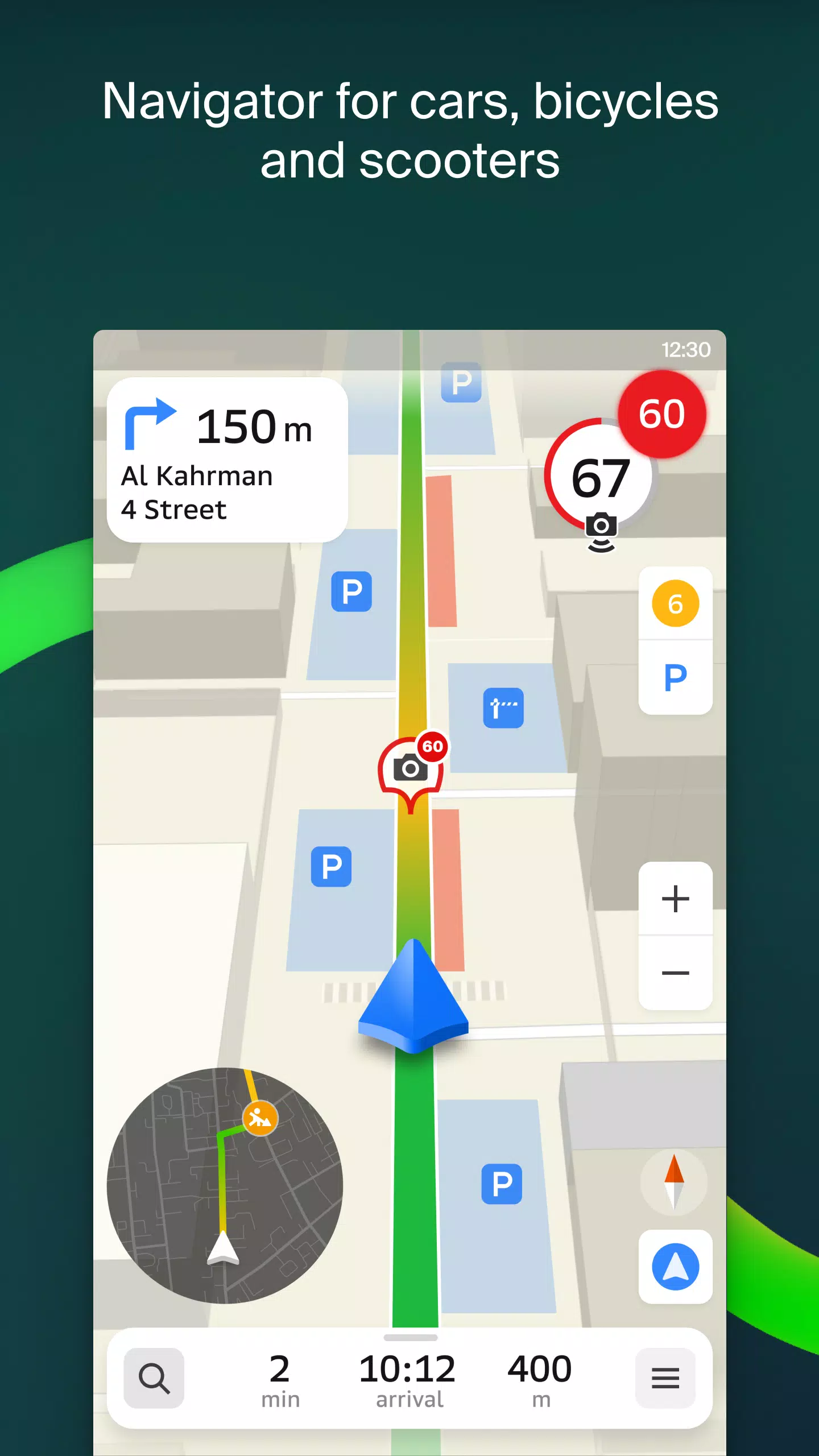
The GPS navigation feature takes into account real-time traffic conditions, road signs, speed cameras, toll roads, and unpaved routes. It can plot routes between cities and through multiple points. For Android users, there's a free app compatible with Android Auto.
Stay connected with loved ones using the live friends' location feature on the map. Track the GPS locations of your kids or friends to ensure their safety, send fun stickers, and check battery levels. You control who can see your location and manage your sharing settings.
Stay informed about road events like accidents, blocked streets, and speed cameras, with user comments directly visible on the map.
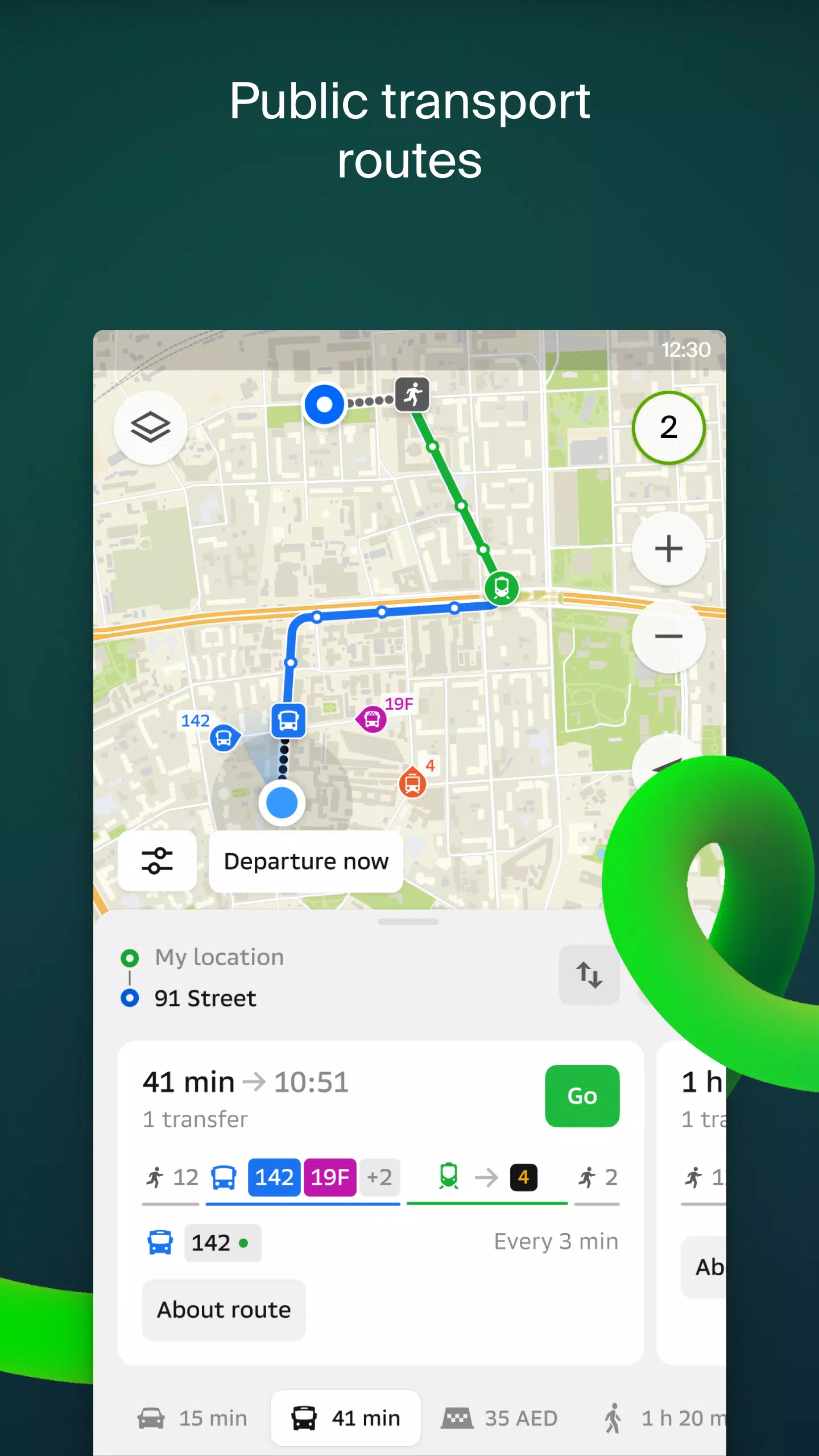
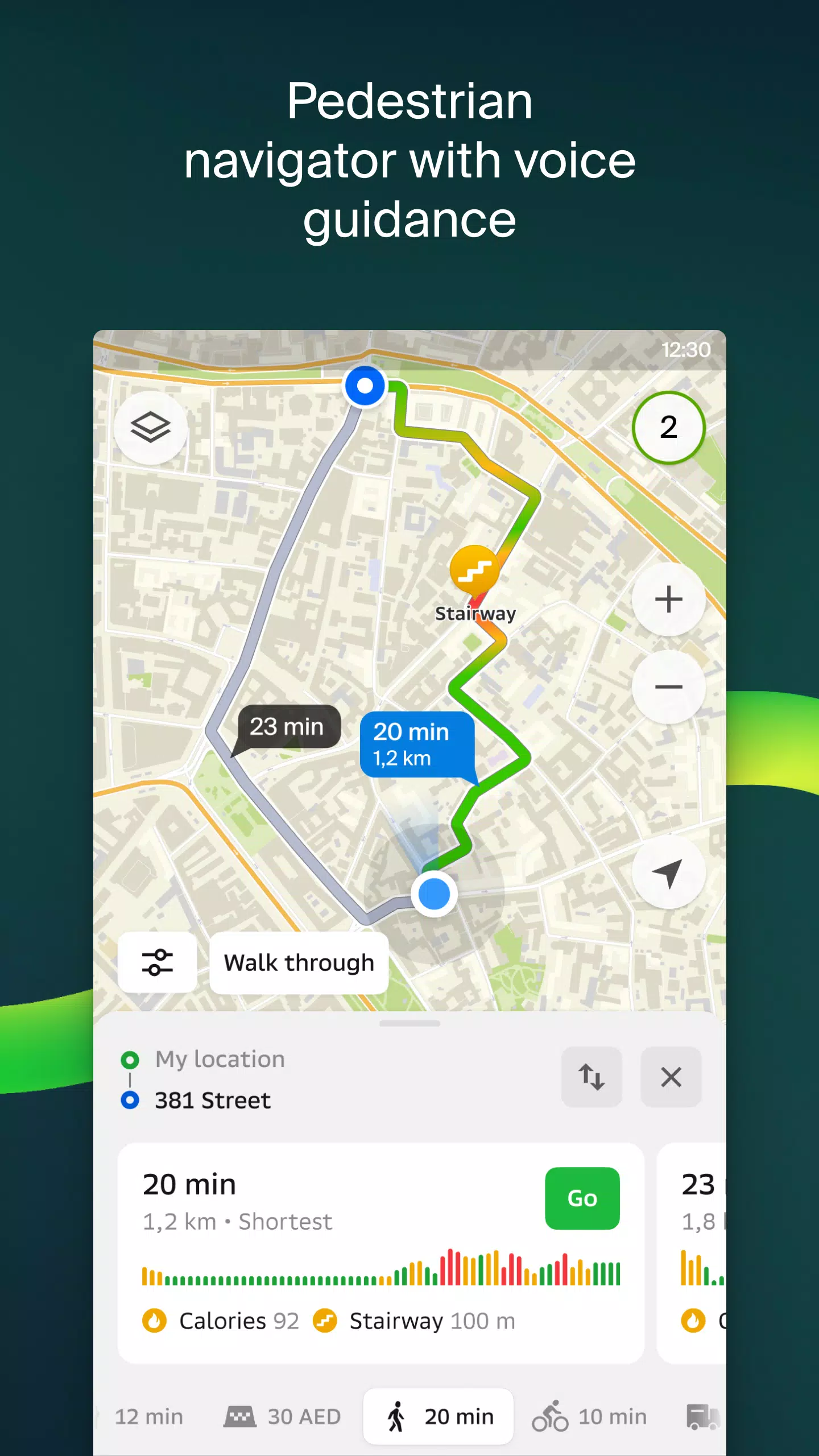
2GIS keeps you updated on public transport with timetables and real-time routes. Our pedestrian navigation guides you on foot, working in the background with voice directions.
For truck drivers, the cargo navigator considers the unique characteristics of your vehicle and cargo to plot the best routes.
Our detailed directory includes addresses, entrances, postal codes, phone numbers, operating hours, social media links, websites, and entrance locations. Users can contribute by adding photos and writing reviews of businesses.
Explore new cities like a local with our travel guide, which highlights main attractions and Wi-Fi hotspots on the map.
Enhance your navigation experience with the 2GIS Notifications companion app for smartwatches on Wear OS. This handy tool helps you navigate routes on foot, by bike, or using public transport directly from the main 2GIS app. It provides map views, maneuver hints, and vibration alerts when you approach turns or destination bus stops. The companion app automatically starts when you begin navigation on your phone and is compatible with Wear OS 3.0 or later.
Available maps cover cities across various countries:
- Cities of the UAE: Dubai, Sharjah, Abu Dhabi, Al Ain, Ajam, Ras Al Khaimah, Fujairah, Umm Al Quwain, Dibba Al Fujairah, Khor Fakkan, Kalba, Al Salamh, etc.
- Cities of Russia: Moscow, Saint Petersburg, Novosibirsk, Ekaterinburg, Krasnoyarsk, Chelyabinsk, Ufa, Omsk, Kazan, Perm, Nizhny Novgorod, Sheregesh, etc.
- Cities of Belarus, Kazakhstan, Uzbekistan, Azerbaijan, and Kyrgyzstan: Minsk, Pavlodar, Semey, Aktau, Aktobe, Almaty, Nur-Sultan, Bishkek, Karaganda, Kokshetau, Kostanay, Osh, Baku, Tashkent, etc.
For any assistance or inquiries, feel free to reach out to our support team at [email protected].
Tags : Maps & Navigation